28 to 30 October 2025, Postojna, Slovenia
Airborne laser scanning for farmed landscapes
TRAIL Theme
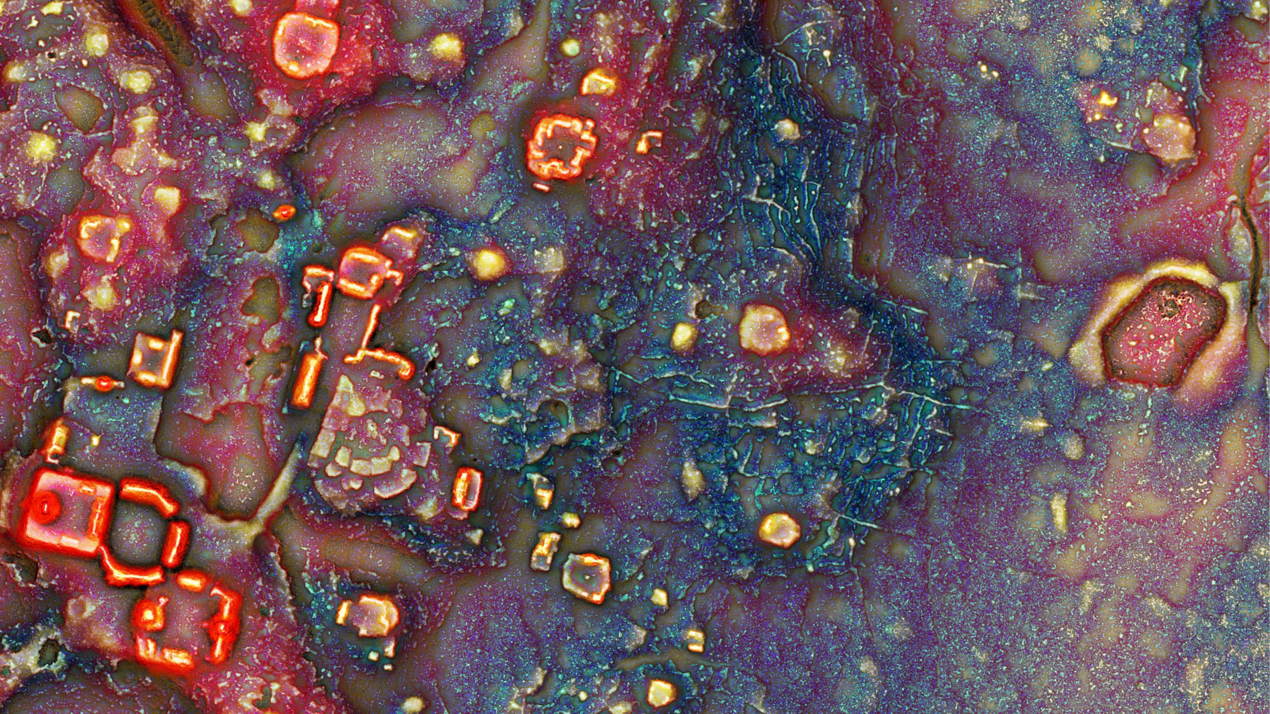
Archaeological applications of Airborne Laser Scanning (ALS) data have often emphasised the power of the data in wooded environments, where the capacity to image ground surfaces below the canopy has been a game-changer for prospection. Considerable attention has also been given, quite rightly, to the ability to document the surface topography of archaeological remains in ground which has not suffered attrition from historic or current cultivation, especially increasingly mechanised ‘heavy’ ploughing.
Less attention has been given to heavily cultivated, mainly lowland, landscapes – the traditional focus of aerial archaeology documenting cropmarking in predominately arable fields. In these regions of increasingly heavily ploughing archaeological remains have been flattened and removed, and that is undoubtedly a key reason for the lack of attention paid to such areas in ALS-driven projects. Nevertheless, ALS data has demonstrable, if under-exploited, value in such environments and this is the focus of the TRAIL 2025 meeting.
As well as considering the applications of ALS data in landscapes dominated by heavy contemporary cultivation, the workshop will also consider the role of such data in considering farmed landscapes of all periods. These represent particular challenges to archaeologists as cultivation tends to erode or completely remove the remains of earlier periods. As a result, ‘farming’ is often an archaeologically invisible process that nevertheless has profound implications for what is preserved in the complex palimpsests of our landscapes. Farmers have been working and reworking landscapes for millennia and understanding those processes at landscapes scales remains a significant challenge.
These themes will be addressed through a series of lectures and interactive workshops. The TRAIL Meeting will close with a roundtable to discuss key challenges and opportunities in the use of lidar for farmed landscapes.
Agenda
Tuesday, 28 October 2025
| 8:45-10:00 | Workshop session 0: Gentle introduction in the archaeological interpretation of lidar derived data |
| 10:00-10:30 | break |
| 10:30-11:45 | Workshop session 0: Gentle introduction in the archaeological interpretation of lidar derived data |
| 12:00-13:15 | lunch |
| 13:30-14:00 | Introduction to the meeting |
| 14:00-16:00 | Keynote 1 by Dave Cowley Attrition, palaeo-landscapes, and the patterns of the past in farmed landscapes Keynote 2 by João Fonte Do we really need drone-derived lidar data in landscape archaeology? Keynote 3 by Jürgen Landauer Let the landscape talk about its archaeology: from AI based site detection to Vision Language Models |
| 16:00-17:00 | coffee break and poster session |
| 17:00-18:30 | Invited lecture 1 by Elise Fovet Data quality (resolution, precision, accuracy) – what you can expect for archaeological exploration Invited lecture 2 by Nives Doneus and Michael Doneus What you see is what you get: past land use and lidar methodology in the northern Adriatic coastal region Invited lecture 3 by Łukasz Banaszek The cream of the crop! ALS data for cropmark archaeology |
| 19:00-20:00 | dinner |
Wednesday, 29 October 2025
| 7:00-8:15 | breakfast |
| 8:45-10:00 | Introductory discussion about workshops |
| 10:00-10:30 | coffee break |
| 10:30-12:30 | Workshop session 1 |
| 12:30-13:30 | lunch |
| 13:30-16:30 | Field trip afternoon (2 choices) – a walk or the cave |
| 17:00-19:00 | Workshop session 2 |
| 19:30-21:00 | International dinner |
Thursday, 30 October 2025
| 7:00-8:15 | breakfast |
| 8:45-10:45 | Workshop session 3 |
| 10:45-11:15 | coffee break |
| 11:15-12:30 | Round table discussion and closing session |
| 12:30-13:30 | lunch |
Workshops
Gentle introduction in the archaeological interpretation of airborne lidar derived data
Rebecca Bennett, Luka Škerjanec
In this workshop we take a look at the process of identifying and interpreting potential archaeological features from lidar derived data. Using the EAC good practice guidelines as a guide, we will explore interpretation as an iterative process, thinking about the challenges of what to record and how. Participants are encouraged to bring their own examples for discussion.
Archaeological ground point filtering of lidar point clouds
Michael Doneus, Hannah Weiser, Zoran Čučković
An important task in the processing of airborne laser scanning data is the derivation of appropriate models (terrain, surface, feature). Setting up such classification and filtering workflows can be time-consuming and prone to information loss, especially in geographically heterogeneous landscapes. AFwizard is an open source Python package designed to improve the productivity of ground point filtering workflows in archaeology and beyond. It provides a Jupyter-based environment for human-in-the-loop, spatially heterogeneous ground point filtering. Through hands-on training, the participants will learn how to study the effects of different algorithm and parameter combinations on digital terrain modelling in a practical and time-saving way. In addition, the AFwizard settings will be tested and analysed using simulated lidar survey scenarios (e.g., airborne, UAV, terrestrial) and point densities. In order to learn how different point cloud properties affect the filtering process, the open source simulator HELIOS++ will be introduced and used together with AFwizard in a hands-on exercise. This will allow for improved filtering of existing data as well as future survey planning.
Automatic Detection of Archaeological Features (ADAF)
Žiga Kokalj, Nejc Čož, Jürgen Landauer
The rapid development of image analysis techniques and the increasing availability of high-quality airborne laser scanning data (ALS, lidar) are encouraging the use of machine learning in archaeology. The ADAF tool consists of two Jupyter notebooks, one for training (creating specific machine learning models) and one for automatic recognition of archaeological features. While the training part is time-consuming and requires suitable hardware, the recognition part can be done on any modern laptop. This workshop aims to provide participants with hands-on experience with the software and enable them to use it independently for their own projects. We will cover the basics of deep learning in archaeology, the installation, explain all components of the training part and run the detection process. The currently implemented model is optimised to detect three classes of Irish archaeology (barrows, enclosures, ringforts), but you can also input your own model. The software requires minimal interaction and no prior knowledge of machine learning techniques, which greatly increases its accessibility to the archaeological community. The software is tested to run on Windows.
Processing UAS lidar data
Jitte Waagen, Luka Škerjanec, Elise Fovet, João Fonte
The advent of UAS-based lidar has brought exciting new opportunities to the field of near-surface remote sensing. Of course, it makes it possible to collect lidar data where none is available, but the flexibility of drone deployment also allows control over data collection, creating new opportunities such as optimising timing, flight patterns and so on and so forth. However, the large amounts of data collected by UAS-based lidar pose challenges for data processing. This workshop will cover strategies for dealing with the classification and filtering of high resolution point clouds using software such as LAStools and CloudCompare.
Presentations
KEYNOTE 1
Attrition, palaeo-landscapes, and the patterns of the past in farmed landscapes
Dave Cowley
The impact of increasingly heavily mechanised cultivation on the character of the historic landscape and the survival of archaeological remains is perhaps self-evident. The distribution of such activity is one of the most important factors that impact the survival and visibility of archaeological remains. But of course, such activity, if not as heavily mechanised, has been taking place for millennia. This paper will take some examples from Scotland to consider the role of ALS data in exploring such landscapes, from thinking about palaeo-landscapes to the enduring impact of farming practice and the difficulties of identifying and understanding the farmed surfaces of the past.
KEYNOTE 2
Do we really need drone-derived lidar data in landscape archaeology?
João Fonte
The advent of drone-based lidar has transformed landscape archaeology, providing unprecedented flexibility and high-resolution data. However, the significant increase in data density raises concerns about the efficiency of data handling and processing, and the practical need for such detail. This presentation will present a comparative analysis of drone-based and airborne lidar data from a number of archaeological sites in the Iberian Peninsula, critically examining the trade-offs between data resolution, processing requirements and archaeological insight.
KEYNOTE 3
Let the landscape talk about its archaeology: From AI based site detection to Vision Language Models
Jürgen Landauer
Today, archaeologists have access to high-quality airborne laser scanning (ALS, lidar) data covering an increasing number of regions around the world. Researchers have made spectacular finds, especially under the canopy. But the abundance of data available, sometimes referred to as the ‘big data problem’, contrasts with the limited number of human experts and calls for the search to be automated. Deep learning, a subfield of artificial intelligence (AI), is currently the most promising method for automating the search for previously unknown features in landscape archaeology.
This talk reports on key findings from numerous AI projects since 2018, searching for features ranging from charcoal kilns, barrows and Celtic grave gardens to large or even amorphous types such as hollow roads and hillforts. We focus on projects of provincial and national scale, and present ideas for solutions to the particular challenges posed by their scale.
We then show how, in the not-too-distant future, researchers will be able to literally ask questions of their field of research using Vision Language Models (VLMs). These siblings of ChatGPT promise much easier access to AI, as they no longer require AI training in advance.
INVITED LECTURE 1
Data quality (resolution, precision, accuracy) – what you can expect for archaeological exploration
Elise Fovet
An increasing amount of airborne laser scanning (ALS) data is now publicly available, offering valuable opportunities for archaeological research. Nationwide ALS surveys and archived datasets continue to grow, yet their quality varies significantly. The quality of the data is impacted by a variety of factors, including differences in flight parameters, sensor technology, scanning seasonality, and advancements in data processing.
ALS surveys are conducted for diverse purposes, but not all are appropriate for cultural heritage studies. In the field of archaeology, lidar applications are highly specialised, prioritising micro-relief detection and landscape anomalies, which demand high-quality data. It is therefore vital to understand the limitations, potential applications, and overall suitability of lidar data originally collected for other purposes.
This lecture introduces key concepts for evaluating lidar datasets and explores the criteria that define high-quality ALS data for archaeological research. What makes a dataset suitable for archaeology? Can less precise data, initially acquired for other applications, still be useful?
INVITED LECTURE 2
What you see is what you get: past land use and lidar methodology in the northern Adriatic coastal region
Nives Doneus and Michael Doneus
The widespread use of large-scale archaeological prospection techniques over the last two decades has shifted the archaeological focus from an interest in individual sites to a holistic view of cultural landscapes. In this context, and particularly in the study of Mediterranean landscapes, airborne laser scanning (ALS, lidar) serves as a robust tool that can yield particularly promising results. ALS data offer insights into the relationship between human settlement activities and the natural environment and help to understand how the land has been used to meet human needs. The development of relative stratigraphic information from lidar data is an essential aspect, as it can provide an insight into the temporal development and change of regional land use patterns.
The results of several Croatian case studies, mainly from the Roman period, show that land use remains, such as relics of agro-pastoralism and land division, can be considered as part of the material culture and an expression of culture and society. Decoding past (agricultural) landscapes from lidar data is therefore a viable approach to better understanding of historical processes.
INVITED LECTURE 3
The cream of the crop! ALS data for cropmark archaeology
Łukasz Banaszek
Applications of airborne laser scanning in archaeology tend to focus on examining surface topography. Less well explored is the potential for such data to investigate levelled archaeological features that are expressed through differential arable crop growth (cropmarks). This is partly because topographic and archaeological airborne lidar surveys are often undertaken outside the crop growing season, limiting the potential to explore this aspect of lidar data.
However, ALS sorties can take place at the peak period of cropmark formation if the recording of surface objects, e.g. buildings, trees, and power lines, takes priority over detailed representation of the terrain. In addition, a wet and windy cold season in countries such as Scotland, i.e. November to March, complicates data acquisition, thus limiting the leaf-off data acquisition window. As a result, data collected over spring and summer is available for the analysis of cropmarks.
The lecture evaluates ALS-derived height and radiometric data against traditional aerial reconnaissance outcomes across the Scottish Lowlands. Also drawing on Sentinel-2 satellite imagery and targeted field visits, I discuss the utility of large-area leaf-on airborne laser scanning data in recording cropmark archaeology.
Excursion
Šilentabor archaeological complex

Šilentabor Hillfort
Perched on the edge of a prominent ridge known as Taborski greben, between the villages of Narin to the west and Zagorje to the east, the Šilentabor archaeological site is a striking example of a multi-period settlement. The central feature is a prehistoric hillfort, naturally protected by steep, sometimes sheer slopes on its western and northern flanks—towering up to 200 meters above the valley floor.
To secure the more accessible eastern and southern approaches, two substantial stone ramparts were constructed. These defensive structures subdivided the site into two areas: a larger upper settlement spanning approximately 7 hectares and a smaller lower enclosure covering 2.83 hectares. The origins of the fortification likely date to the Late Bronze Age, with continued use through the Iron Age and into the Roman period. During the Middle Ages, the site saw renewed activity as it was repurposed into a fortified castle complex.
Church of St. Martin
Located just south of the hillfort stands the Church of St. Martin, a structure built in the Romanesque architectural tradition. Archaeological excavations at this site have uncovered the foundations of an earlier Early Christian church. Noteworthy finds include the remains of a clergy bench (subsellium) and fragments of a Late Antique hanging glass lamp, shedding light on the site’s long-standing religious significance.
Grmada Hillfort
Grmada is one of the elongated summits along the Taborski greben ridge. At its eastern peak lies a semicircular stone rampart enclosing an area of approximately 0.84 hectares. As with other hillforts in the region, its western side is naturally fortified by steep slopes that rise dramatically up to 200 meters above the valley.
Analysis of lidar-derived data has revealed additional archaeological features, including an inner rampart, signs of ancient terracing, and a fainter, outer semicircular fortification. Unfortunately, modern activities have significantly damaged parts of this outer structure.
Excursion organisers
dr. Boštjan Laharnar (National Museum of Slovenia), Luka Škerjanec (ZRC SAZU)
Literature
Laharnar, B. 2022, From Ocra to Albion – Notranjska between Prehistory and Antiquity. Catalogi et Monographiae 45, National Museum of Slovenia.
Organizing committee
- Žiga Kokalj, ZRC SAZU, Ljubljana, Slovenia
- Luka Škerjanec, ZRC SAZU, Ljubljana, Slovenia
- Nejc Čož, ZRC SAZU, Ljubljana, Slovenia
- Elise Fovet, Université Clermont Auvergne, Clermont-Ferrand, France
- Dave Cowley, Historic Environment Scotland, Edinburgh, United Kingdom
- Philip Verhagen, Vrije Universiteit Amsterdam, Amsterdam, The Netherlands
- Jitte Waagen, University of Amsterdam, Amsterdam, The Netherlands
- Jernej Rihter, ZRC SAZU, Ljubljana, Slovenia
- Urška Stražišar, ZRC SAZU, Ljubljana, Slovenia
Scientific Committee
- Apostolos Sarris, University of Cyprus, Nicosia, Cyprus
- Arianna Traviglia, Istituto Italiano di Tecnologia, Venice, Italy
- Axel Posluschny, Keltenwelt am Glauberg, Glauberg, Germany
- Dave Cowley, Historic Environment Scotland, Edinburgh, United Kingdom
- David Novak, Institute of Archaeology of the Czech Academy of Sciences, Prague, Czech Republic
- Edin Bujak, University of Sarajevo, Sarajevo, Bosnia and Herzegovina
- Elise Fovet, CNRS / UAR 3550 MSH Clermont-Ferrand , Clermont-Ferrand, France
- Grzegorz Kiarszys, University of Szczecin, Szczecin, Poland
- Hector Orengo, GIAP, Catalan Institute of Classical Archaeology (ICAC), Tarragona, Spain
- Ina Miloglav, University of Zagreb, Zagreb, Croatia
- Jitte Waagen, University of Amsterdam, Amsterdam, Netherlands
- Laure Nuninger, CNRS / UAR 3124 MSHE C.N. Ledoux – UMR 6249 Chrono-Environnement, Besançon, France
- Michael Doneus, University of Vienna, Vienna, Austria
- Nejc Čož, ZRC SAZU, Ljubljana, Slovenia
- Philip Verhagen, Vrije Universiteit Amsterdam, Amsterdam, The Netherlands
- Tibor Lieskovský, Slovak University of Technology , Bratislava, Slovakia
- Vujadin Ivanišević, Archaeological Institute, Belgrade, Serbia
- Zoltán Czajlik, Eötvös Loránd University, Budapest, Hungary
- Žiga Kokalj, ZRC SAZU, Ljubljana, Slovenia
Organisers and financers
The sixth TRAIL Meeting is organized by ZRC SAZU (Slovenia) in partnership with Historic Environment Scotland (United Kingdom), CNRS (France), University of Clermont Auvergne (France), CLUE+, Vrije Universiteit Amsterdam (The Netherlands), and University of Amsterdam (the Netherlands). It is financially supported by ZRC SAZU, Historic Environment Scotland, Aerial Archaeology Research Group, Slovenian Research and Innovation Agency (programme P2-0406) and European Research Council (project STONE, GAP-101089123).